![](/images/other/stat-length.png)
![Excursión Cicloturismo Florac Trois Rivières - boucle florac ste Eminie, causse Mejean en boucle - Photo](https://media.geolcdn.com/t/1900/400/ext.pjpeg?maxdim=2&url=https%3A%2F%2Fstatic1.geolcdn.com%2Fsiteimages%2Fupload%2Ffiles%2F1524743154velo.jpg)
boucle florac ste Eminie, causse Mejean en boucle
martoche
Usuario
![Longitud](/images/other/stat-length.png)
![Altitud máxima](https://static1.geolcdn.com/siteimages/upload/files/1508320355ic_sort_altitude_max_24dp.png)
![Desnivel positivo](https://static1.geolcdn.com/siteimages/upload/files/1508320355ic_sort_den_pos_24dp.png)
![Km-Effort](/images/other/stat-length.png)
![Altitud mínima](https://static1.geolcdn.com/siteimages/upload/files/1508320355ic_sort_altitude_min_24dp.png)
![Desnivel negativo](https://static1.geolcdn.com/siteimages/upload/files/1508320355ic_sort_den_neg_24dp.png)
![Boucle](https://static1.geolcdn.com/siteimages/upload/files/16400158638029165_repeat_loop_refresh_sync_direction_icon.png)
![Cicloturismo](https://static1.geolcdn.com/sitytour/trail-icons/204.png)
5h36
Dificultad : Difícil
![Escanee este código QR para abrir la excursión en la aplicación SityTrail](https://capi.geolives.com/qq0zvz2zws4bq2lad0pu/sitytour/trails/3700233/qr.png?size=200)
Aplicación GPS de excursión GRATIS
A propósito
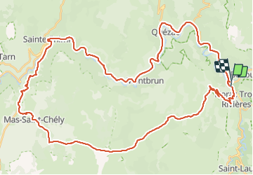
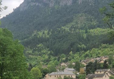
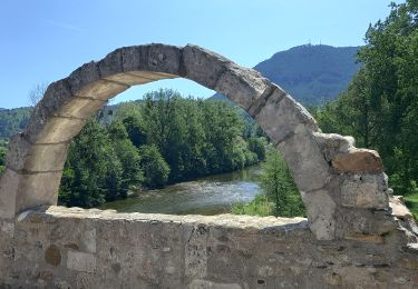
Ruta Cicloturismo de 62 km a descubrir en Occitania, Lozère, Florac Trois Rivières. Esta ruta ha sido propuesta por martoche.
Descripción
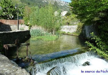
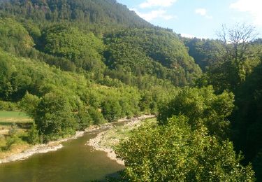
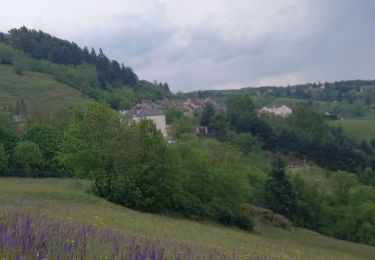
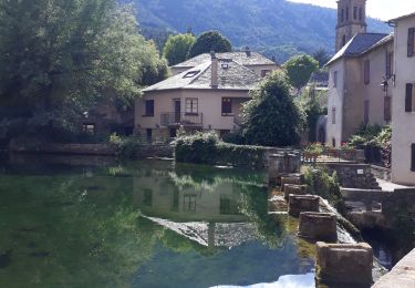
magnifique boucle en partant de Florac, puis ste Enimie, et grimpe sur le Causse Mejean, et descente raide ( prudence) sur Florac
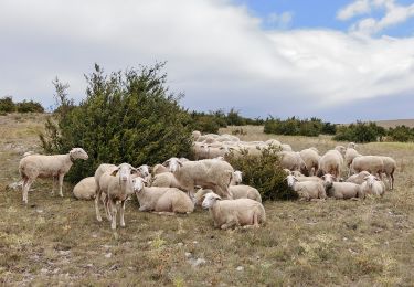
la montée au Causse est granduose.
L'application donne 1200 de D , mon altimetre n'en donne que 820 m bizarre bizarre.
Localización
Comentarios
Excursiones cerca
![Excursión Senderismo Florac Trois Rivières - Le Sentier des Couronnes - Florac - Photo](https://media.geolcdn.com/t/375/260/ext.jpg?maxdim=2&url=https%3A%2F%2Fservices.sitytrail.com%2FGeolivesWS%2FDownloadMedia.ashx%3FTrailID%3D129855%26Media%3D13413_6.jpg)
![Senderismo Senderismo](https://static1.geolcdn.com/sitytour/trail-icons/101.png)
Senderismo
![](/images/other/stat-length.png)
![](https://static1.geolcdn.com/siteimages/upload/files/16400158638029165_repeat_loop_refresh_sync_direction_icon.png)
![Excursión Senderismo Ispagnac - Ispagnac et Quezac - Photo](https://media.geolcdn.com/t/375/260/ext.jpg?maxdim=2&url=https%3A%2F%2Fservices.sitytrail.com%2FGeolivesWS%2FDownloadMedia.ashx%3FTrailID%3D449646%26Media%3Dfix__20150725172954.jpg)
![Senderismo Senderismo](https://static1.geolcdn.com/sitytour/trail-icons/101.png)
Senderismo
![](/images/other/stat-length.png)
![](https://static1.geolcdn.com/siteimages/upload/files/16400158638029165_repeat_loop_refresh_sync_direction_icon.png)
![Excursión Senderismo Bédouès-Cocurès - Stevenson Bedouès Barre des Cévennes - Photo](https://media.geolcdn.com/t/375/260/86b0857f-5630-4b37-8494-7a00373be256.jpg&format=jpg&maxdim=2)
![Senderismo Senderismo](https://static1.geolcdn.com/sitytour/trail-icons/101.png)
Senderismo
![](/images/other/stat-length.png)
![](https://static1.geolcdn.com/siteimages/upload/files/16400158638029165_repeat_loop_refresh_sync_direction_icon.png)
![Excursión A pie Florac Trois Rivières - Florac - Photo](https://media.geolcdn.com/t/375/260/f2a77ee2-7a86-4802-91d2-226710ca6f1c.jpeg&format=jpg&maxdim=2)
![A pie A pie](https://static1.geolcdn.com/sitytour/trail-icons/100.png)
A pie
![](/images/other/stat-length.png)
![](https://static1.geolcdn.com/siteimages/upload/files/16400158638029165_repeat_loop_refresh_sync_direction_icon.png)
![Excursión Senderismo Florac Trois Rivières - Panoramique des couronnes - Photo](https://media.geolcdn.com/t/375/260/7019c90e-f046-4f38-8c65-fb0ab66f3f22.jpg&format=jpg&maxdim=2)
![Senderismo Senderismo](https://static1.geolcdn.com/sitytour/trail-icons/101.png)
Senderismo
![](/images/other/stat-length.png)
![](https://static1.geolcdn.com/siteimages/upload/files/16400158638029165_repeat_loop_refresh_sync_direction_icon.png)
![Excursión Senderismo Florac Trois Rivières - Les Cévennes sentiers sympas - Photo](https://media.geolcdn.com/t/375/260/39fe67cd-54e7-4946-b242-3ad32b0a4775.jpg&format=jpg&maxdim=2)
![Senderismo Senderismo](https://static1.geolcdn.com/sitytour/trail-icons/101.png)
Senderismo
![](/images/other/stat-length.png)
![](https://static1.geolcdn.com/siteimages/upload/files/16400158638029165_repeat_loop_refresh_sync_direction_icon.png)
![Excursión Senderismo Florac Trois Rivières - Etape 8 Florac/Cassagnas - Photo](https://media.geolcdn.com/t/375/260/495f7742-b660-4cb5-bdb0-98f953d0eda5.jpg&format=jpg&maxdim=2)
![Senderismo Senderismo](https://static1.geolcdn.com/sitytour/trail-icons/101.png)
Senderismo
![](/images/other/stat-length.png)
![](https://static1.geolcdn.com/siteimages/upload/files/16400158638029165_repeat_loop_refresh_sync_direction_icon.png)
![Excursión Senderismo Bédouès-Cocurès - 14-05-2023 E9 Bédouès - Barre des Cévennes - Photo](https://media.geolcdn.com/t/375/260/c49eac84-f99f-43af-9f22-014089784d72.jpg&format=jpg&maxdim=2)
![Senderismo Senderismo](https://static1.geolcdn.com/sitytour/trail-icons/101.png)
Senderismo
![](/images/other/stat-length.png)
![](https://static1.geolcdn.com/siteimages/upload/files/16400158638029165_repeat_loop_refresh_sync_direction_icon.png)
![Excursión Senderismo Florac Trois Rivières - de Florac à St Enimie par le Causse de Sauveterre - Photo](https://media.geolcdn.com/t/375/260/166b8a72-b2d0-4c55-bf4e-bd92beaeab4e.jpg&format=jpg&maxdim=2)
![Senderismo Senderismo](https://static1.geolcdn.com/sitytour/trail-icons/101.png)
Senderismo
![](/images/other/stat-length.png)
![](https://static1.geolcdn.com/siteimages/upload/files/16400158638029165_repeat_loop_refresh_sync_direction_icon.png)